Walled Buildings
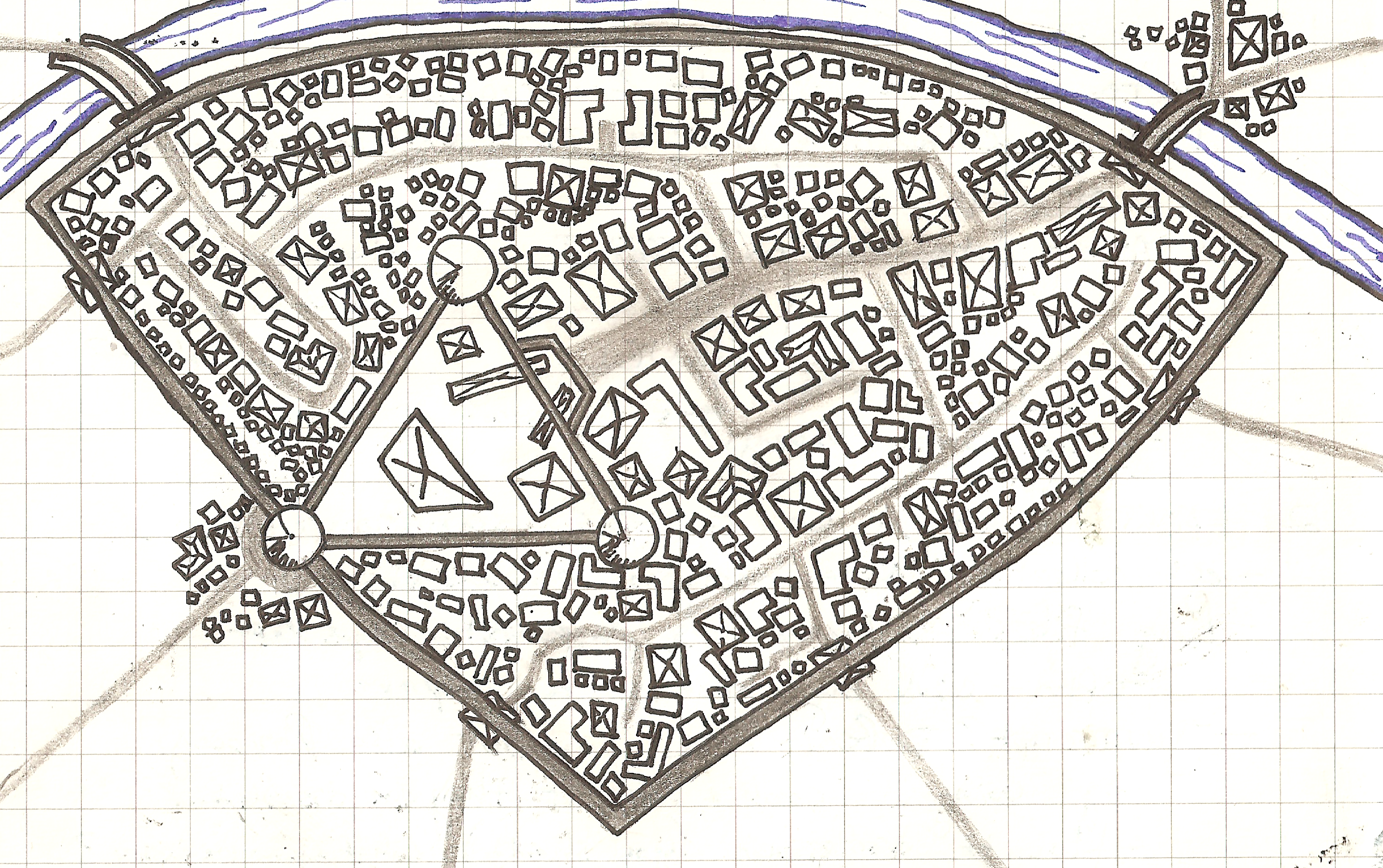
A walled city next to a river, with buildings shown explicitly and unpaved roads implied with negative space.
I’ve been seeing a lot of amazing maps inspired by Jerry’s Map. A lot of them are at a very close scale, so individual buildings are shown. I had been playing with how to draw maps like this, and was not having success drawing buildings wherever I felt they should go.
For this map, I started with the river, walls, and inner “castle”. Then, in pencil, I added the major roads and minor roads off of those. I added buildings, trying to keep the density varied. Then I erased everything and added major roads where they made sense.
I imaging the roads in pencil are paved, and all other gaps between buildings may act as roads but are unpaved. Some of the roads leaving the city might not be paved, but they are so frequently used they should be shown.
I also added smaller groups of buildings outside the walls. I imagine the cluster outside the inner castle is a heavily trafficked market and fair plaza. The other cluster, to the North East of the city and across the river, is likely a waypoint for traders and peasants before entering the expensive city.
I like this style and I want to practice more of it. I think there is lots to try and learn here…