Maps by Date
Londonish
A very dense city centered around the confluence of two rivers, inspired by London, England.
I finally made a city that doesn’t just look like an alternative universe Portland! This city was influenced by London, since I have been studying the maps in anticipation of my upcoming visit.
Walled Buildings
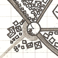
A walled city next to a river, with buildings shown explicitly and unpaved roads implied with negative space.
I’ve been seeing a lot of amazing maps inspired by Jerry’s Map. A lot of them are at a very close scale, so individual buildings are shown. I had been playing with how to draw maps like this, and was not having success drawing buildings wherever I felt they should go.
Farmed Expanse
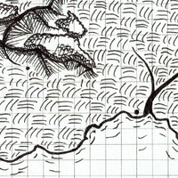
I learned a few new styles to detail the landmasses!
It had been a while since I tried to fill in the landmasses of my maps. I wanted to show mountains as more than cones. I followed this tutorial from Fantastic Maps. I think the mountains came out looking good, but they are more of a single ridge and doesn’t imply many peaks.
No-Grid Attempt
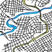
After friends told me all my city maps were too closely aligned to a grid, I tried to make one that wasn't.
On a road trip to Kentucky, some of my friends said my city maps didn’t seem realistic. I base most of my city maps off of Portland, Oregon, which has a river and a clear grid system. Still, I wanted to branch out and try something new.
World Border
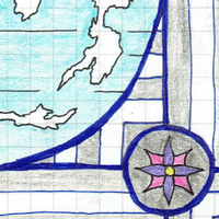
A world map with stylized borders and an unclear projection.
I have not named this world, but have drawn closer scale versions of parts of it. This map was drawn during my “stylized borders” phase, yet has relatively plain ones excepting the four flours in each quadrant. The map is also minimal in that it only shows landmasses, and no rivers, mountains, or political borders.
Terrain
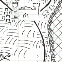
A map that has a little of everything.
I made this map to practice different types of terrains in a clean style. In the north is a coniferous forest, until it runs into the mountain range. A deciduous forest takes over on the south of the mountains and runs to the coast in the east. Farms (or perhaps plains?) take up the large southern biome.
South End
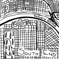
The South End, paradoxically, is located in the central western district of this city, indicating a history of urban growth
This city was drawn with the intent to practice drawing a city in the order it was built. I drew the river first, then followed up with the bridge and most of the roads close to the river. However, I went straight to pen and was not able to revise as I went. The city grew somewhat inorganically. It skipped time in certain spots, especially around the highway. The labels were added in the middle of drawing the map, so they interfered with the organic growth of the city.
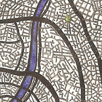
City Closeup
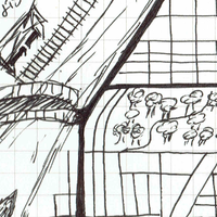
One of the first city maps I ever drew, this map is heavily influenced by Portland, OR.
In the top left of the map, you can see a purple schematic map. I had written down directions to an event in Worcester, and drew the majors streets I would see. I still managed to get lost, but I was inspired by the schematic to draw my own city map. Like most major cities, it is based on a river and has a railroad near it. Other Portland influences are the (implied) hills that break up the grid pattern along the right side, and an island in the middle of the river (bottom left). This was a quick sketch done in all ink, and no “urban planning” went into this map.
Licence
Please use, distribute, and remix these maps! All maps are licensed under a Creative Commons Attribution-NonCommercial 4.0 International License, so you are free to include them in personal and open-source projects.
